Puffing Billy & Healesville Sanctuary Tour

Puffing Billy & Healesville Sanctuary Tour
The Dandenong Ranges (commonly just The Dandenongs) are a set of low mountain ranges, rising to 633 metres at Mount Dandenong, approximately 35 km (22 mi) east of Melbourne, Victoria, Australia. The ranges consist mostly of rolling hills, steeply weathered valleys and gullies covered in thick temperate rainforest, predominantly of tall mountain ash trees and dense ferny undergrowth.
After European settlement in the region, the range was used as a major local source of timber for Melbourne. The ranges were popular with day-trippers from the 1870s onwards. Much of the Dandenongs were protected by parklands as early as 1882 and by 1987 these parklands were amalgamated to form the Dandenong Ranges National Park, which was subsequently expanded in 1997. The range receives light to moderate snowfalls a few times in most years, frequently between late winter and late spring.
The etymology of the Dandenongs is a complicated one. Two names have been used to refer to the ranges; Corhanwarrabul and Dandenong, both derived from the Woiwurrung language of the Wurundjeri people. It is thought that the name Dandenong was applied to the ranges due to being the origin of the Dandenong Creek; however, the original name for Dandenong Creek was Narra Narrawong. The origin of the name Dandenong is unknown, as is its meaning or correct spelling with other variations include; Tanjenong, Tangynon and Bangeong. In any case, both names relate to watercourses rather than mountains or ranges, as indicated by the ong ending. Given that the name Dandenong may not apply to anything in the immediate area, the relevance of the name Corhanwarrabul becomes apparent. Carhanwarrabul (pronounced either "corhan-warrabul" with a silent "h", or "cor-hana-warrabul") or Koran warrabin[1] was the original name for one of the two main summits, perhaps both or perhaps the entire range. The name applied to the main summits and was in continued use up until around 1900, when the name Dandenong appeared. At any rate, Corhanwarrabul remains the most relevant name for the ranges to date.
The range is the remains of an extinct volcano last active 373 million years ago. It consists predominantly of Devonian dacite and rhyodacite.
The topography consists of a series of ridges dissected by deeply cut streams. Sheltered gullies in the south of the range are home to temperate rain forest, fern gullies and Mountain Ash forest Eucalyptus regnans, whereas the drier ridges and exposed northern slopes are covered by dry sclerophyll forest of stringybarks and box. The entire range is highly prone to bushfires, the most recent of which have been the 1983 Ash Wednesday bushfires, the 1997 Dandenong Ranges bushfires and small fires during the Black Saturday bushfires in 2009.
The Dandenong Ranges are home to a variety of native Australian mammal, bird, reptile and invertebrate species. Well-represented bird species include the Sulfur-crested cockatoo, Superb lyrebird, Laughing kookaburra, and Crimson Rosella. Mammals include the Short-beaked echidna, Common wombat, Sugar glider, and Swamp wallaby. Invertebrates include two species of burrowing crayfish.
Step into a timeless world of wonder with Australia’s favourite steam train, Puffing Billy. Whether it’s energetic adventure, a touch of nostalgia or cultural experiences, there is something for everyone at Puffing Billy Railway.
The railway was originally one of five narrow gauge lines of the Victorian Railways opened around the beginning of the 20th century. It runs through the southern foothills of the Dandenong Ranges to Gembrook. Being close to the city of Melbourne and with a post-preservation history spanning over 50 years, the line is one of the most popular steam heritage railways in the world, and attracts tourists from all over Australia and overseas.
The Puffing Billy Railway is kept in operation through the efforts of volunteers of the Puffing Billy Preservation Society, although intensive year-round operations have led to a few dozen paid employees to keep things going behind the scenes. The railway aims to preserve and restore the line as near as possible to how it was in the first three decades of its existence, but with particular emphasis on the early 1920s.
The line was opened in 1900 to serve the local farming and timber community but stopped running in 1953 after a landslide blocked the line between Selby and Menzies Creek, and it was formally closed in 1954.
Following closure, a few farewell specials operated on the remaining usable section to Belgrave, which proved very popular. On 1 October 1955, the Puffing Billy Preservation Society was formed to keep the train running indefinitely. Operations were gradually extended and the remainder of the original line through Clematis to Emerald was opened on 31 July 1965 and Lakeside on 18 October 1975 before reaching Gembrook, which was opened on 18 October 1998. The first trains to Gembrook carried children from the primary schools along the Belgrave–Gembrook corridor, two of which directly adjoin the railway corridor and with the remainder not more than a street away.
Today the railway operates as a popular tourist activity over 15 miles (24 km) with original steam engines, and is operated with some of the railway practices from the Victorian Railways 1900 to 1930 era, such as using the "Staff and Ticket" safeworking method and having conductors on board the trains.
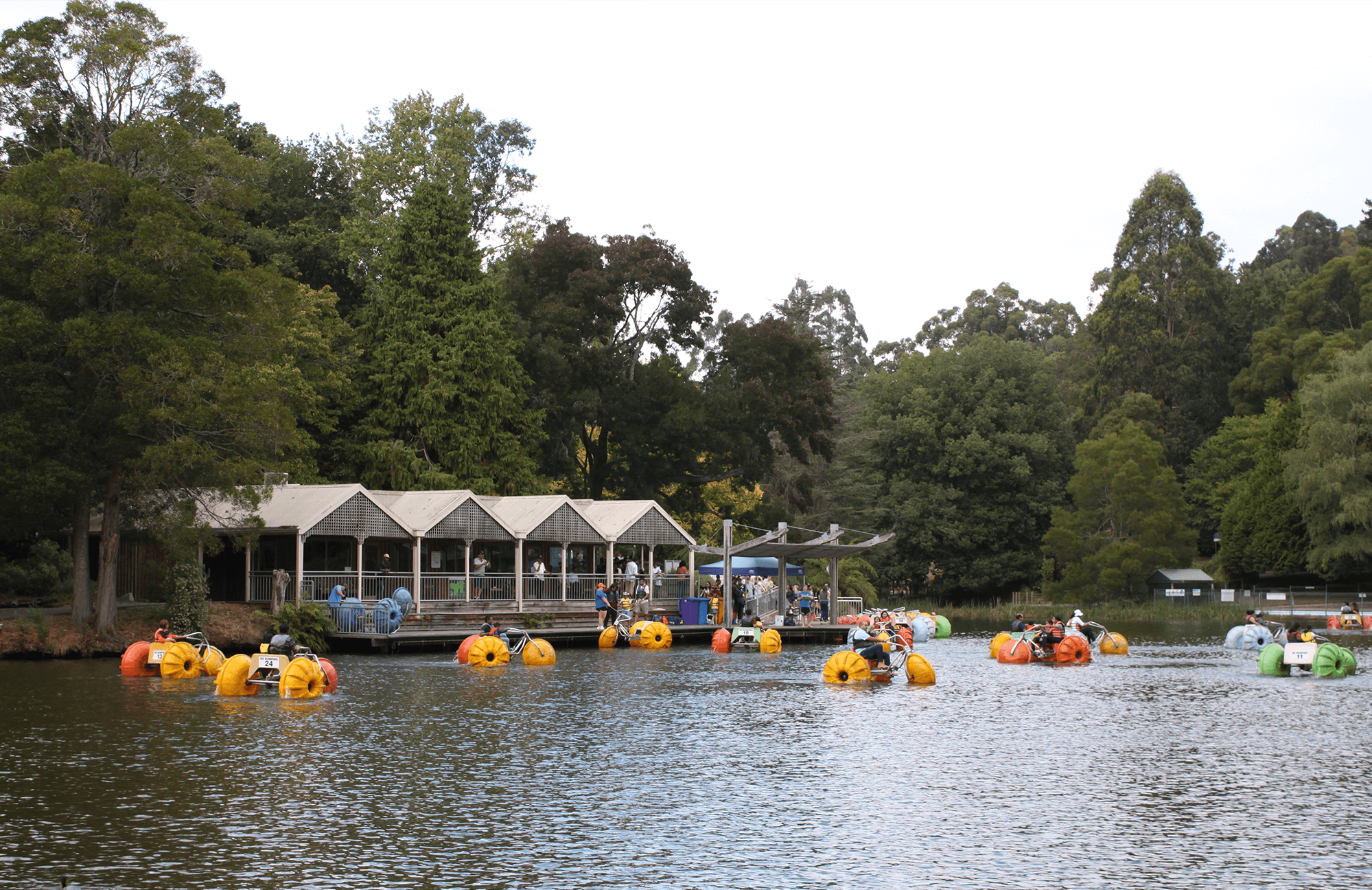
Emerald Lake (Lake Treganowan) offers barbecue facilities, children's playgrounds, a pool, paddle boats, walking tracks, fishing, Environment Centre, model railway, café, and a railway station on the Puffing Billy Railway.
Emerald Lake and its nearby park was originally a part of the historic Nobelius Nursery. This nursery was actually started during the 1890s with the planting of fruit and ornamental trees. As the lake area is rich in soil, the agricultural and horticultural growth was abundant. In 1941, the 50 hectares of land belonging to the original nursery was later opened as a public park. Today, Emerald Lake and its park are two popular tourist attractions within the Dandenong Ranges, with the Puffing Billy scenic railway line nearby along with the Emerald Lake Model Railway. Set within the hillside and native bushlands, the lake offers a number of scenic picnic grounds and walking trails, where you can picnic and take part in various outdoor activities. Many people come to Emerald Lake for fishing as there is an abundance of rainbow trout within its waters.
The Yarra Valley is the region surrounding the Yarra River in Victoria, Australia. The river originates approximately 240 km (150 mi) east of the Melbourne central business district and flows towards it and out into Port Phillip Bay. The name Yarra Valley is used in reference to the upper regions surrounding the Yarra River and generally does not encompass the lower regions including the city and suburban areas, where the topography flattens out, or the upper reaches which are in inaccessible bushland. Included in the Yarra Valley is the sub-region of the Upper Yarra Valley which encompasses the towns of the former Shire of Upper Yarra in the catchment area upstream of and including Woori Yallock. The Yarra Valley is a popular day-trip and tourist area, featuring a range of natural features and agricultural produce, as well as the Lilydale to Warburton Rail Trail.
The Yarra Valley is host to a thriving wine growing industry. The area's relatively cool climate makes it particularly suited to the production of high-quality chardonnay, pinot noir and sparkling wine. Yarra Valley towns fall under the Nillumbik and Yarra Ranges Shire Councils. Major towns include Coldstream, Yarra Glen, Healesville and Warburton.
Fun Fact: The Yarra Valley food bowl produces 78% of Victoria’s Strawberries! It is brimming with local food producers offering orchards of cherries, apples, stone fruit and berries, vegetables, cheeses, poultry, ice creams, chocolates, artisan breads and an array of specialty seasonal produce introduced to the region from generations of immigrant settlers, such as pasta, chilli, capsicum, persimmons, smoked fish, and salmon.
Healesville is well known for the Healesville Sanctuary, a nature park with hundreds of native Australian animals displayed in a semi-open natural setting and an active platypus breeding program. The Yarra Valley Railway operates from Healesville Station every Sunday, most public holidays and Wednesday to Sunday during school holidays. Schools in Healesville include the Healesville Primary School, St Brigid’s Catholic primary school, the rural Chum Creek Primary School, Badger Creek Primary School, Healesville High School and Worawa Aboriginal College, an Aboriginal school whose former students include noted Australian Rules Footballer David Wirrpanda. Much of what is now Healesville lies on the ancestral land of the Wurundjeri people. An Aboriginal reserve known as Coranderrk, set up in 1863, was located just south of the main township. Industries in and around Healesville include sawmilling, horticulture, tourism and viticulture. Healesville has an active CFA (Country Fire Authority) volunteer fire brigade established in 1894. The Healesville Rural Fire Brigade was formed in 1941, and disbanded and membership amalgamated with the Healesville Urban Fire Brigade in 1985. The amalgamation of the Chum Creek Rural Fire Brigade with the Healesville brigade occurred in 1996. The Healesville Fire Brigade now operates a main and a satellite station with members from both the Healesville and Chum Creek areas. Healesville is the southern terminus of the Bicentennial Heritage Trail, which, at 5,330 km (3,310 mi), is the longest trail of its type in the world. The northern end of the trail is at Cooktown, Queensland, a town 328 kilometres (204 mi) north of Cairns.
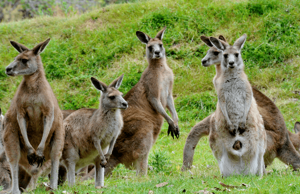
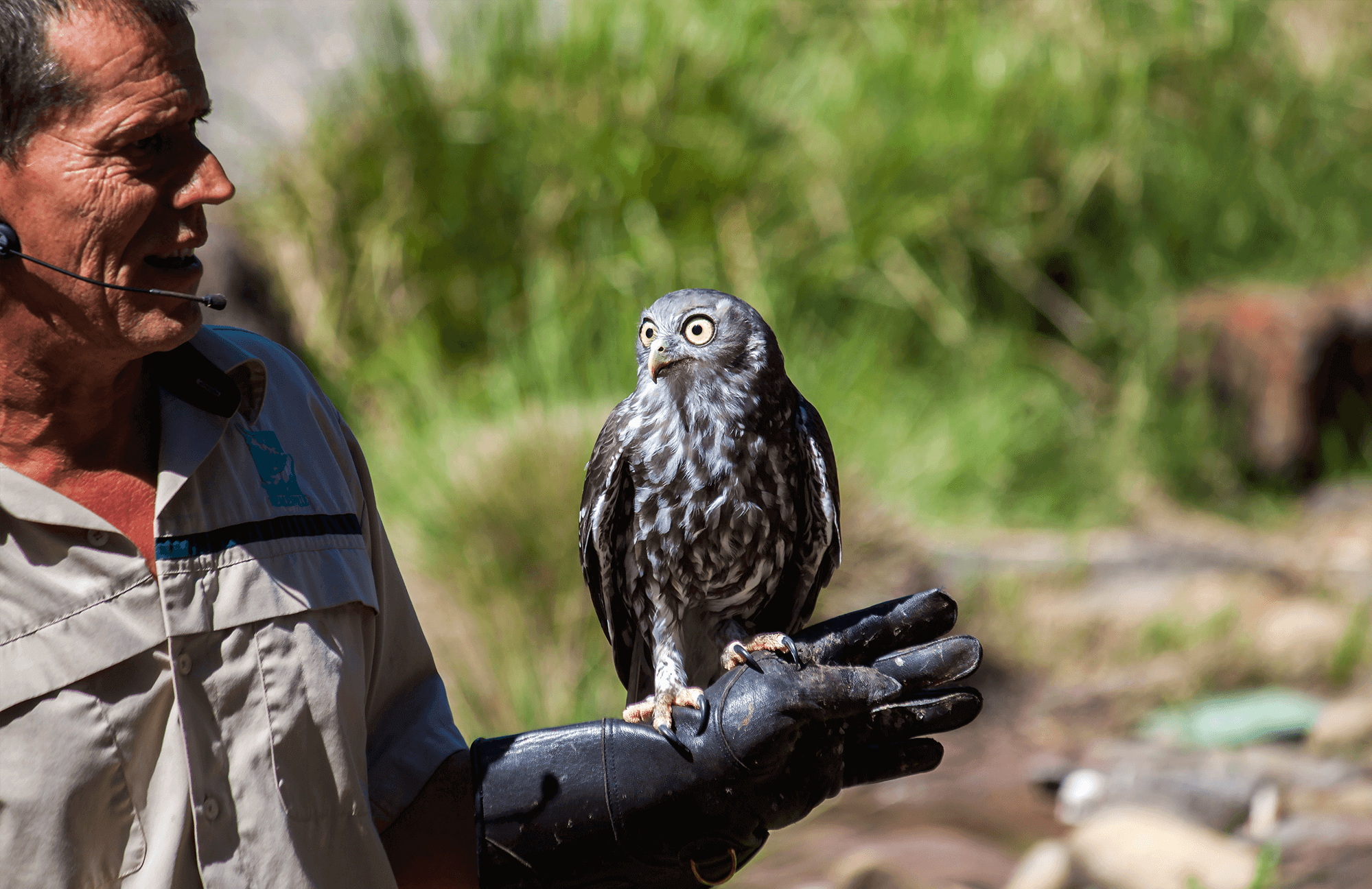
Healesville Sanctuary is a zoo specialising in native Australian animals. It is located at Healesville in rural Victoria, Australia, and has a history of breeding native animals. It is one of only two places to have successfully bred a platypus, the other being Sydney's Taronga Zoo. It also assists with a breeding population of the endangered helmeted honeyeater. The zoo is set in a natural bushland environment where paths wind through different habitat areas showcasing wallabies, wombats, dingoes, kangaroos, and over 200 native bird varieties. An Australian wildlife experience, wander tranquil tracks and see iconic Australian animals including koalas, kangaroos, platypus, dingoes, wombats, emus and more. Discover majestic birds of prey and magnificent parrots in the spectacular Spirits of The Sky bird show. Take a visit to the Australian Wildlife Health Centre to meet the vets and nurses as they care for sick, injured or orphaned wildlife in need of care.
Dr Colin MacKenzie (knighted in 1929) set up the Institute of Anatomical Research in 1920 on 78 acres (32 ha) of land which had formerly been part of the Aboriginal reserve known as Coranderrk. The Reserve passed to the Healesville Council in 1927 and became the Sir Colin MacKenzie Sanctuary in 1934.
You’ll be welcomed with free tastings and a spectacular showroom choc filled with thousands of handcrafted chocolates and artisan ice creams, plus a 200 seat Cafe serving an all day menu of breakfast, lunch and decadent desserts a specialty. Explore the 40 acres of landscaped grounds, orchard and wetlands area, watch European Chocolatiers at work, discover thousands of handcrafted chocolates from signature truffles to traditional favourites. The care taken to create the Chocolaterie’s collection extends to where and how chocolate is sourced – every step of the process and everyone involved. That’s why the Chocolateries are proudly part of the Cocoa Horizons program that supports farmers and their communities, ensuring their cocoa is sustainably sourced.
